EARSHOT · Plan the links
Know who can reach whom before you step off.
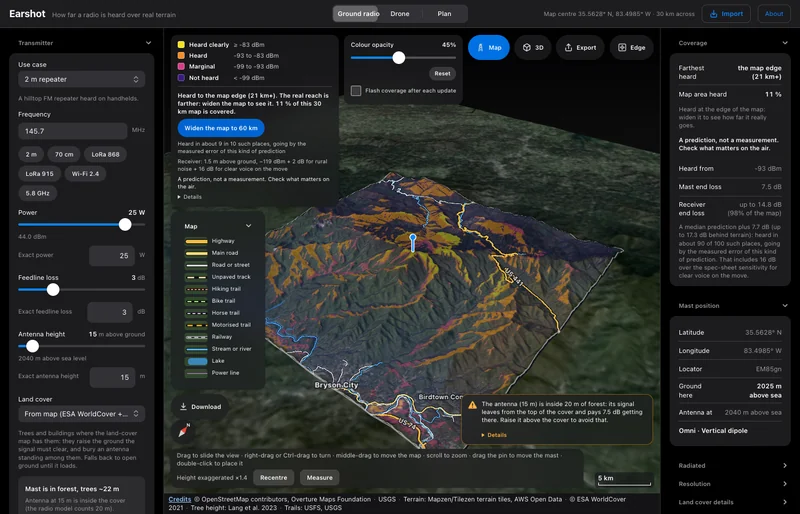
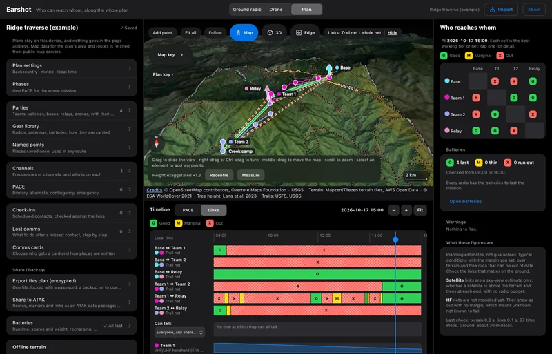
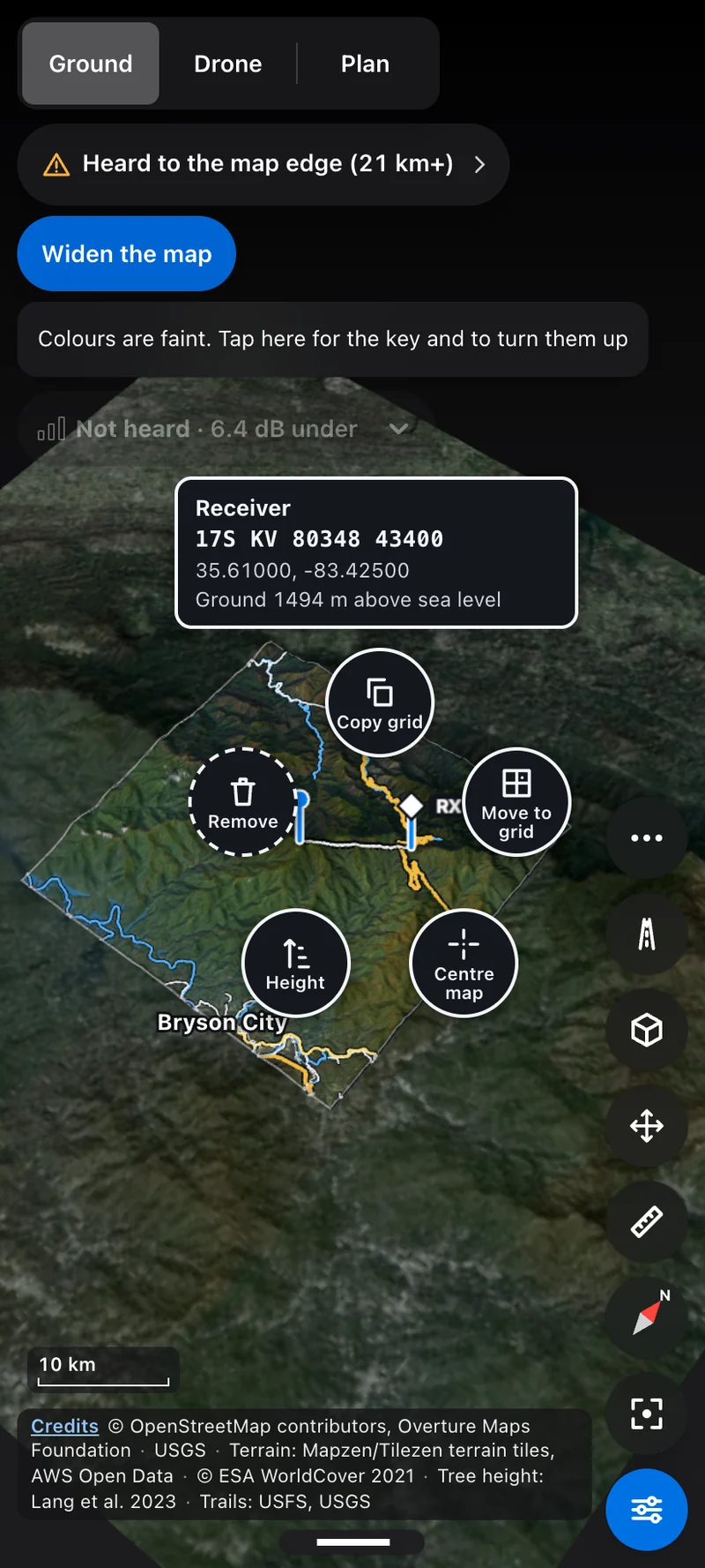
EARSHOT puts a radio on real terrain and shows where it will be heard. Then it checks every link along a route, for people and for drones.
EARSHOT · screen recording
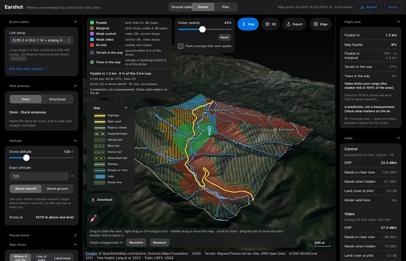
The app in use: where a drone keeps its control and video links, over real terrain.
Three modes, one map
Ground. Drone. Plan.
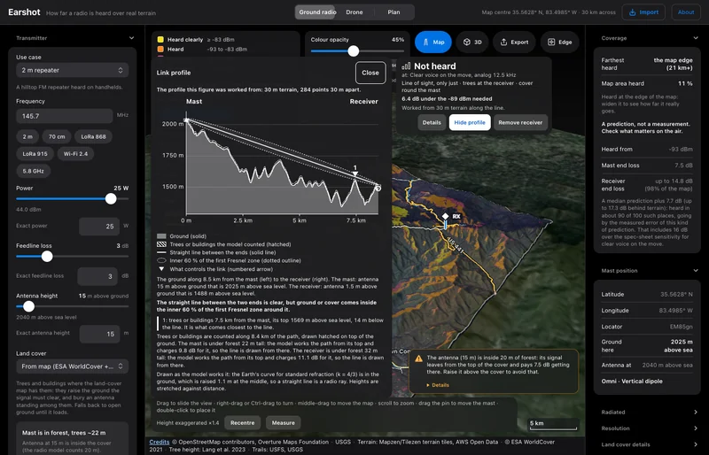
Each mode answers one question, over the real ground, with tree cover and buildings counted against the link.
EARSHOT · drone mode · screen recording
Place the drone. Control holds, video drops. Move it and watch the answer change.
How accurate is it
A prediction, checked against measurements.
The terrain model is the ITU-R P.1812 diffraction method with two additions. Against 16,575 published field measurements it reads 1.1 dB low on average, with an 11 dB spread. That spread is why every answer carries a margin.
- Field measurements it is scored against
- 16,575
- Average error
- −1.1 dB
- RMS spread
- 11.0 dB
EARSHOT has not yet been field-tested in its own right. Its answers are predictions, not measurements, and it is not for safety-of-life use. It does not check licences, frequency coordination or airspace.
Built for the field
On the phone in your pocket, with no signal.
- Offline areas. Download the terrain and map data for an area and work without a connection.
- MGRS grids throughout, with latitude and longitude beside them.
- Plans stay on the device. Sharing is by a password-protected file. Crypto keys are never stored.
- Comms planning. Nets, PACE, check-ins, lost-comms steps, battery runtime and printable comms cards.
- ATAK. Reads routes and markers from ATAK. Coverage export is in testing.
- Measure. Distance, bearing and height difference between two points.
Where it fits
Plan the links. Then rehearse the flight.
EARSHOT answers whether the radios will reach. KESTREL lets the crew fly the same ground first. The two are being built to share one terrain and one link model.
How to get it
Alpha, by request.
EARSHOT is not a public download yet. Tell us what you plan with it and we’ll get you onto the alpha.
- Status
- Alpha
- Runs on
- Web, Android and Windows. Works offline.
- Access
- On request
- Price
- Talk to us